Geography of Alcalá |
||
After Madrid, Móstoles and Valladolid it's the most populated city in the central territory of Spain. The population decreased in 1,3 % in 2007, being about 204.574 inhabitants in 2009. Around villages as Meco, Villanueva de la Torre, Camarma de Esteruelas, Fresno-Serracines, Ajalvir, Torres de la Alameda, Santorcaz, Villalbilla, Daganzo de Arriba, Anchuelo, Los Santos de la Humosa, Corpa y Valverde de Alcalá provide 50.000 inhabitants, forming Great Alcalá. |
The Henares separates two geographic areas that are present in Alcalá de Henares: La Alcarria and the Coutryside of the Henares.
Agricultural soil is mainly for the cereal. Most of this soil is part of the cereal steppes of the rivers Henares and Jarama, that is a known habitat of bustards, little bustards, eagles and endangered birds of prey, etc. 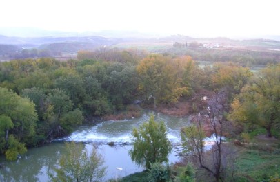 The Alcalá climate is continental mediterranean, with wet and cold winters and dry, hot summers. The yearle temperature average is 14 ºC. Maximum temperatures in summer reaches 40 ºC, being as minumum in winter -10 ºC. The yearly precipitation average is 420 mm. A dryness period happens during the summer. 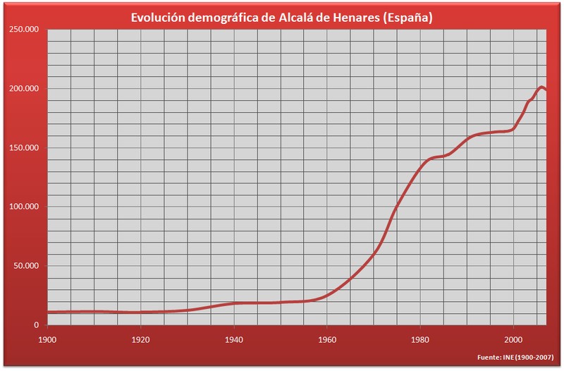 |
|